 IODE 50th anniversary international conference
Liège, Belgium, 21-22 March 2011
Click on the image to start the video
By: Angora Aman, Philip Woodworth and Charles Magori
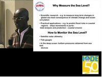
In recent years, there has been increasing concern about the projected rise in the level of the sea surface, due to the global climate change. Analysis of sea level rise is based on tide gauge data taken since the 19th century, as well as historical land records, archaeological data, geological evidence from the Holocene period, and more recently, altimeter data. Continuous sea level records from Africa are very short (generally less than 20 years). Our study provides a review of the Africa dataset, which is limited not only in size, especially given the great length of the coastline, but also in quality. This review is undertaken primarily from Permanent Service for Mean Sea Level (PSMSL) and Global Sea Observing System (GLOSS) perspectives, but the conclusions show that there is a need for major new investments in sea level infrastructure. In 2003, the Government of Flanders (Belgium) and Intergovernmental Oceanographic Commission (IOC) through the programme Ocean Data and Information Network for Africa (ODINAfrica) installed 10 new sea level stations along African coasts. ODINAfrica in collaboration with GLOSS, the Indian Ocean Tsunami Early Warming and Mitigation System, and the Flemish Marine Institute have developed the Tsunami Sea Level Data Facility (www.sealevelstation.net). The new and historical data in combination provide information on the rates of sea level rise along the Gulf of Guinea not well represented in scientific studies to date. The rates were found to be similar to those observed at many other locations around the world.
 Download Presentation (PDF)
Return to Programme Page
- Details
-
Created on: Friday, 01 April 2011 14:04
-
Last Updated on: Monday, 01 July 2013 12:20